
Field Data Management
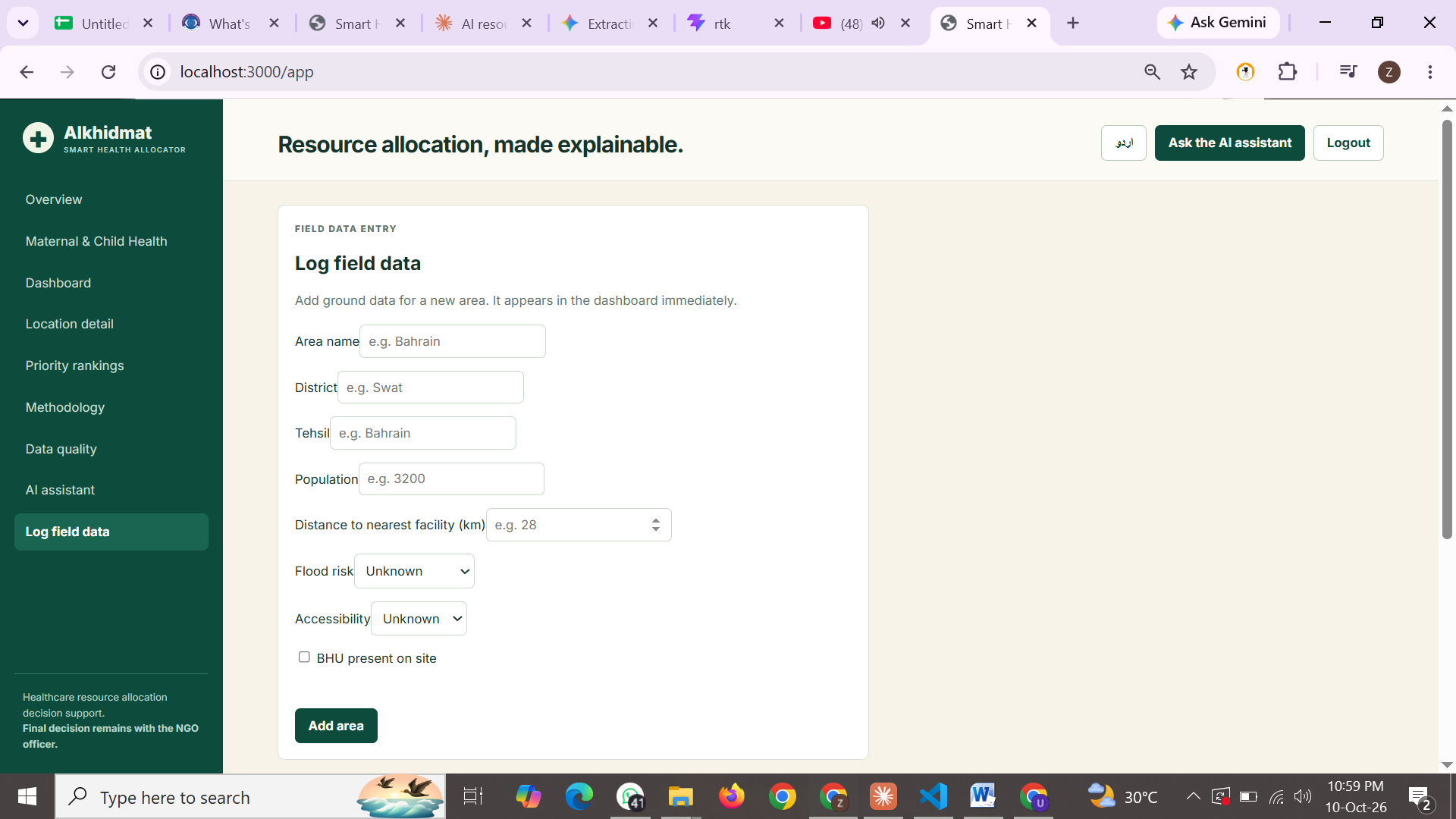
Add villages manually or upload many at once with CSV or Excel. Edit or delete records and the rankings update instantly.
Efficiently manage healthcare resources with data-driven insights, transparent prioritization, and real-time monitoring — especially for rural and underserved areas.

Simple tools. Smarter decisions. Better healthcare.
Add villages manually or upload many at once with CSV or Excel. Edit or delete records and the rankings update instantly.
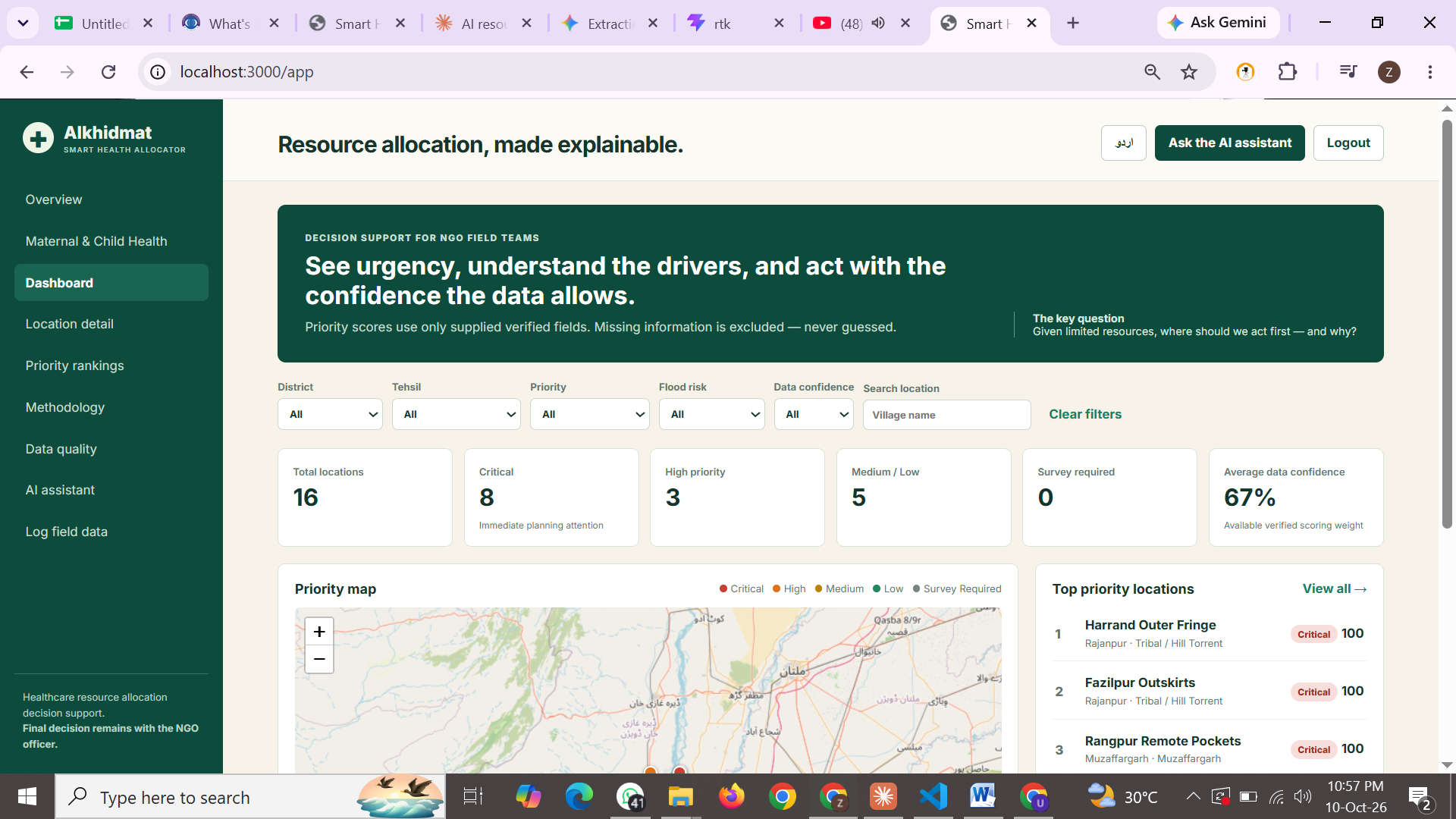
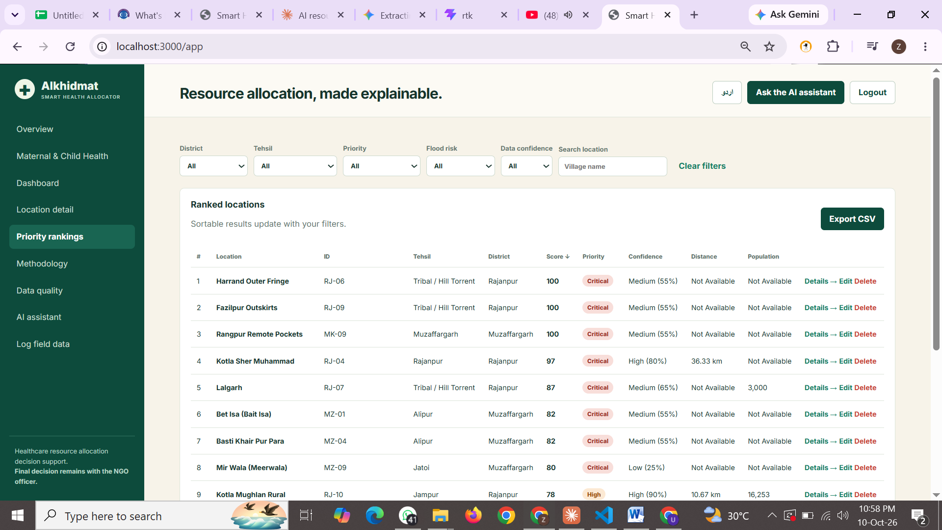
Interactive priority map, filters, ranked tables and CSV export, plus a data quality report that flags missing information.
A transparent 0 to 100 score built from flood risk, facility distance, BHU absence, road access and population, shown with data confidence.
Ask questions in English, Urdu or Roman Urdu. Live WHO indicators and other approved sources appear as reference-only data.

From rural villages to remote areas, healthcare should reach everyone — mothers, children and families, no matter where they live.
A simple and powerful dashboard to manage resources, track emergencies and make informed decisions.
Quick answers about how the platform works.
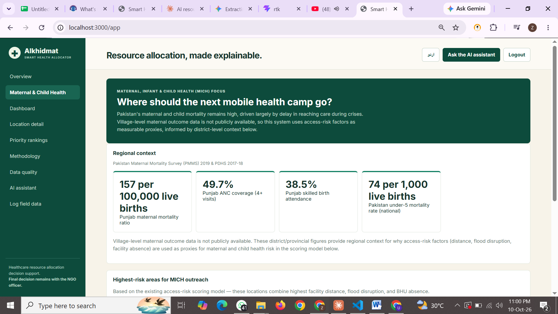
A decision-support dashboard for NGO field teams. It ranks villages by medical vulnerability so maternal, infant and child health camps can reach the highest-barrier areas first.
A transparent 0 to 100 weighted score: flood risk 40%, facility distance 25%, BHU absence 15%, road accessibility 10% and verified population 10%. Missing fields are excluded, never guessed.
From the supplied village dataset plus records your team adds through manual entry or CSV/Excel bulk upload. Live WHO indicators in the AI assistant are shown as reference only and never change the scores.
No. It supports planning. The final allocation decision always remains with the NGO officer.
Log in, open Log field data, and either fill the form or upload a CSV/Excel file. Rankings update immediately.
You can read this page without one. To use the dashboard, create an account from the login screen.
Choose the option that fits you. No login needed.